

Consolidated layer of ecosystems of the Czech Republic
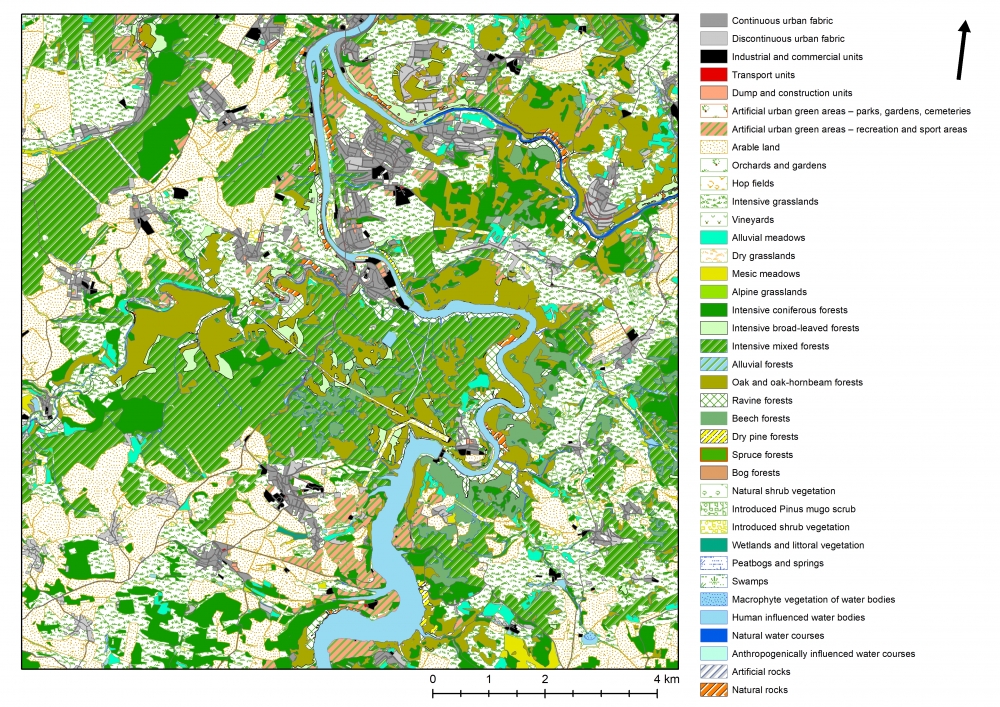
The consolidated layer of ecosystems of the Czech republic (KVES ČR) was created in co-operation with AOPK ČR as a map resource for an assessment of ecosystem services within the project TA ČR TD010066 Integrované hodnocení ekosystémových služeb v České republice. The consolidated layer of ecosystems combines the Layer of biotopes mapping (Vrstva mapování biotopů - VMB) and other data sources for the CR, mainly the Base of geographic data (Základní báze geografických dat - ZABAGED ), Digital base of water management data (Digitální báze vodohospodářských dat - DIBAVOD ), UrbanAtlas, LPIS a CORINE Land Cover. KVES therefore enables a differentiation of natural biotopes and antropogenous types of ecosystems in such a resolution which is suitable for an assessment of ecosystem services. KVES comprises 41 main categories of ecosystems in four hierarchical levels and six wider types of ecosystems. KVES was developed for a national/regional level of assessment. More specific and detailed data sources can be used in a local resolution. At this moment, the data layer is distributed by AOPK ČR, a user and co-author.